Summary: Latitude vs. X

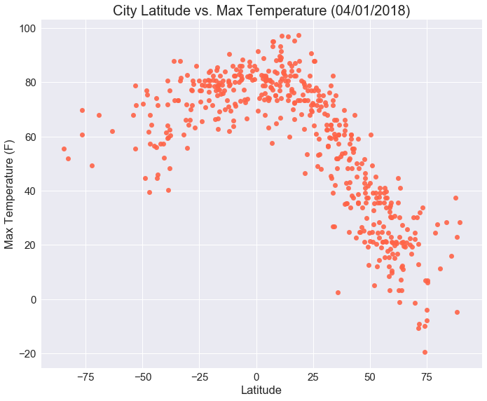
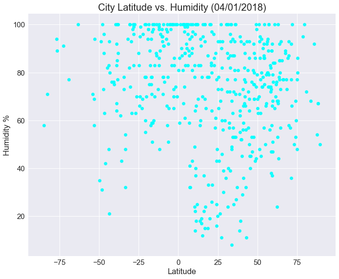
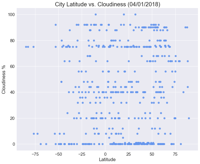
This project's purpose is to show if there is a relationship between latitude and four factors: max temperature, wind speed, humidity, and cloud cover. The city data was pulled from citypy and weather data was pulled from the OpenWeather API. 500 random cities were used for this dataset. Seaborn and matplotlib were used to make the scatter plots, which show the relationship between latitude and the four factors.
While this is a representative model of weather in cities across the world, it is only a snapshot of one day's weather. A yearly or even longer historical view could offer more insight. This site contains the visualizations, analysis, and source data.


